Permaculture design on your actual land
Draw the zones, paths, beds, and trees on the parcel you have, then follow a planting calendar for your USDA hardiness zone.
7-day free trial · No credit card · $7/mo per property
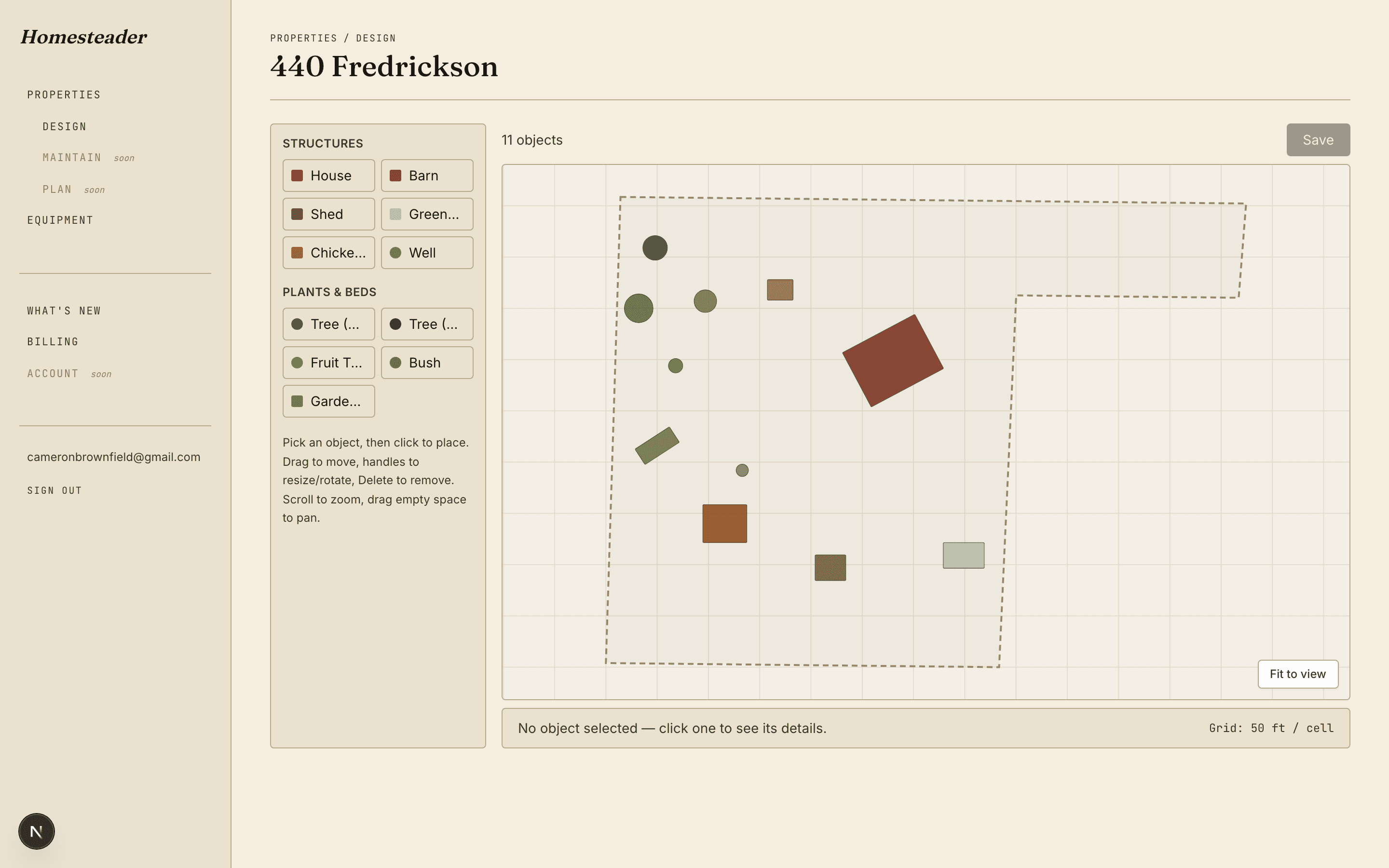
Zones, paths and structures on one canvas
You draw each zone as an area on the canvas, along with paths, roads, garden beds, trees, and structures. Area and edge length stay in feet, and the compass keeps the plan oriented to the ground.
Start from your deed boundary
Paste a metes-and-bounds legal description and Homesteader turns it into the parcel outline you design on. The corners can be adjusted after the import.
Plant catalog and companion pairings
The plant catalog stores pairings for a crop: companion, guild, nitrogen fixer, antagonist, trap crop, and pollinator. Those relationships sit with the species, next to the plants you place on the map.
A planting calendar for your zone
The planting calendar uses your USDA hardiness zone and shows sow, transplant, and harvest windows for the crops you are growing.
From design to the weekly to-do list
The design turns into tasks you add yourself. Set one to repeat weekly — or daily, monthly, or yearly — and assign it to your household. An email digest can list the ones still open.